Mount Kaputar National Park is on Gamilaroi Country. I acknowledge the Traditional Custodians of this area and their connection to Country, and pay my respects to their Elders past and present.
I’m not entirely sure why I decided that Mount Kaputar National Park would make a great hiking destination but it turned out to be a fantastic spot.
It’s a long way from anywhere but if you’ve got time on your hands and love bushwalking, it’s worth making the trek into northern New South Wales to explore the craggy peaks and plateaus of Mount Kaputar.
We had three nights here, and that was just about perfect.
MOUNT KAPUTAR NATIONAL PARK: KNOW BEFORE YOU GO
Mount Kaputar is some 50km east of the country town of Narrabri in northern New South Wales.
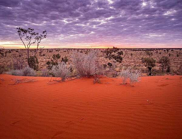
I’d like to say that it’s in the New South Wales outback because it’s so hot and dry there, but it’s really not.
If you look at a map of New South Wales, Mount Kaputar doesn’t seem that far away from the east coast. It looks like it’s just a bit inland from Coffs Harbour until you realise that it’s about an 8-hour drive (~630km) from Brisbane, and not much closer from Sydney (~550km).

Most people approach Mount Kaputar from the town of Narrabri, which means coming from the Newell Highway. This highway’s officially one of the most boring drives in Australia.
There really isn’t much to see beyond the wheat and cotton fields for miles and miles, only occasionally to be interrupted by giant grain silos.

HOW TO GET TO MOUNT KAPUTAR
The national park has three different sections: the Kaputar Plateau, Sawn Rocks and Waa Gorge. Most of the hiking trails are in the main section around the Kaputar Plateau.
To get to the Mount Kaputar Plateau, take Old Gunnedah Road and then Kaputar Road once you’ve hit Narrabri.
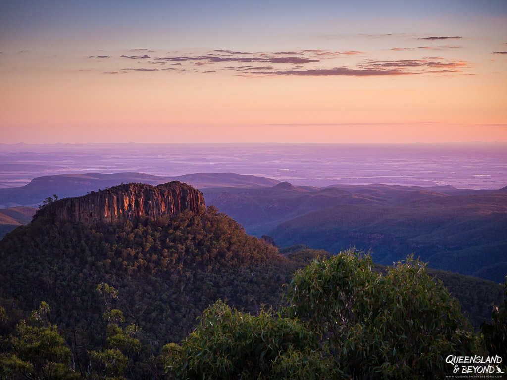
From there, it’s a 53km drive out to the plateau (unsealed but 2WD-accessible). The drive is much more picturesque than you might expect in this barren landscape with the plateau starting to rise in front of your eyes. And you’re in for a treat in terms of hiking.
Both Sawn Rocks and Waa Gorge are north of the Kaputar Plateau so you’ll need to return to Narrabri and the Newell Highway, and then turn off into Killarney Gap Road. Sawn Rocks is just off Killarney Gap Road but it’s about an hour’s drive from the plateau so keep that in mind.
Waa Gorge is even further from the plateau section (about 1.5 hours). To get there, take Killarney Gap Road again but turn off left at Mellburra Road and head north. You can also get there from the Newell if you’re coming that way.
BEST TIME TO VISIT MOUNT KAPUTAR
Given the high temperatures we had in mid-April (mid-30°Cs), I wouldn’t recommend exploring Mount Kaputar over the summer.
Autum and spring are likely going to be the best time as winter might be on the fresher side given the elevation. But if you don’t mind cold weather, July and August might provide perfect daytime temperatures for hiking.
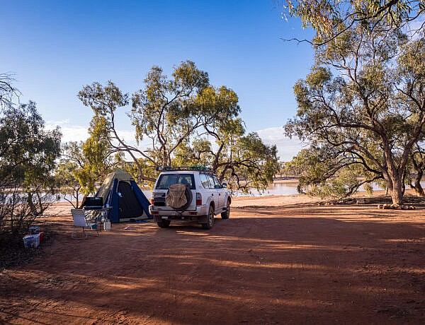
WHERE TO CAMP
You could stay in Narrabri and drive up for the day but it’s so much nicer staying in the national park.
There are two campgrounds to choose from: Bark Hut and Dawsons Spring. It’s $6/night (adults), and you’ll get hot showers with that!
READ MORE: Camping at Bark Hut
If you’re not into camping, NSW National Parks also operates three basic, self-contained huts at the Dawsons Spring campground. You’ll get to sleep in a bed and have access to a small kitchen and bathroom. Booking details are on the NSW Parks website.
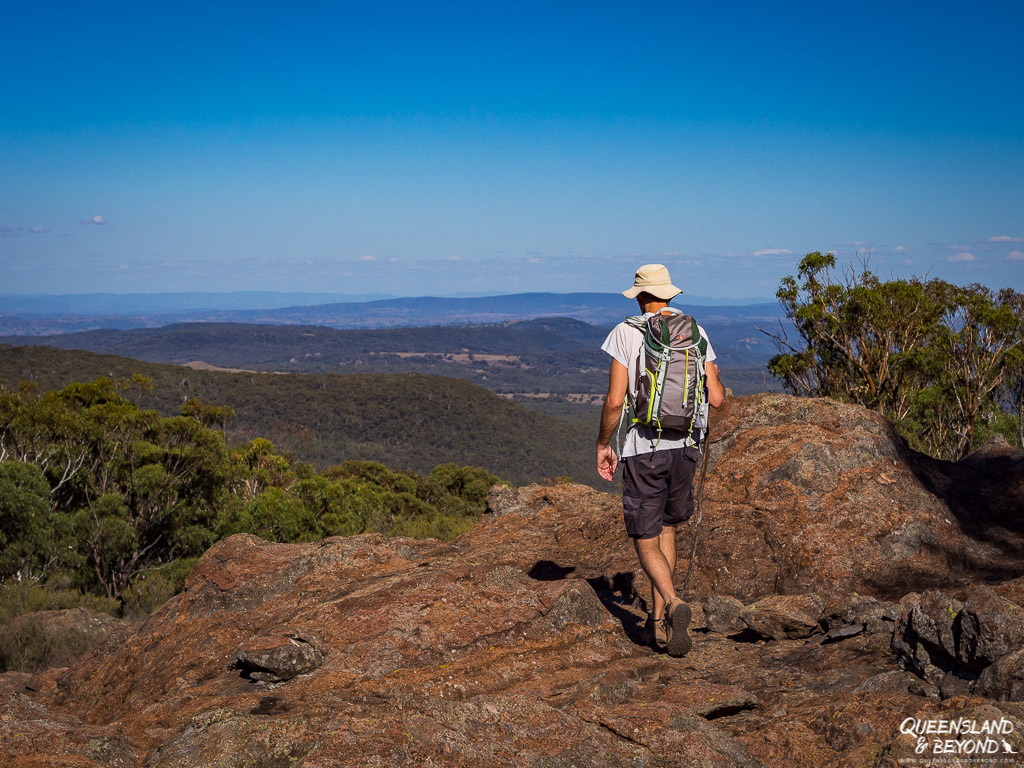
HIKING AT MOUNT KAPUTAR: 5 SHORT BUT FANTASTIC TRAILS
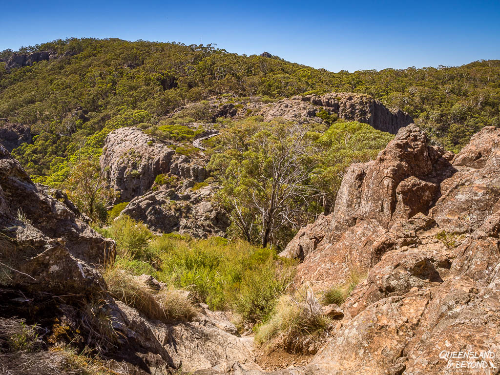
As you drive along the Newell, you can see Mount Kaputar’s volcanic ridges, peaks and plateaus rising above the plains from afar. With the Mount Kaputar summit towering at almost 1,500m above sea level, it’s a steady climb up as you make your way to trailheads, picnic spots and campgrounds.
There’s plenty of very cool rock formations, lava terraces and spectacular viewpoints dotted all over this ancient national park. The country traditionally belongs to the Gamilaroi people but whilst there are some rock carvings and marks on trees, there’s now little evidence of the Gamilaroi’s connection to the land for the (non-Indigenous) visitor to explore.

I didn’t really know how much hiking there would be so I was pretty happy to find several short hikes at Mount Kaputar. There are also a couple of overnight options but you’ll be going off into the wilderness and will need good navigational skills.
With temperatures around 35°C in the surrounding flatlands and still relatively hot weather even at elevation in early April, I just opted for the shorter hikes.
And although the campgrounds were really busy over the long weekend, we met very few people on any of the walks. If you come outside holiday season, you’re unlikely to meet anyone at all. Bliss…
Keep your eyes peeled for wildlife, there are some massive eastern grey kangaroos in these parts. We saw a huge male on the Yulludunida hike and plenty of slightly smaller kangaroos and wallabies on other hikes.

And of course, we couldn’t do a trip without encountering a snake (I did have hopes but it wasn’t to be).
On the Yulludunida hike, the husband barely stopped 30cm in front of a large black snake. We both did quite a jump backwards seeing how it was curled against a rock ledge and didn’t have much space to go anywhere. Luckily for us, the snake decided slithering away was the best tactic here.
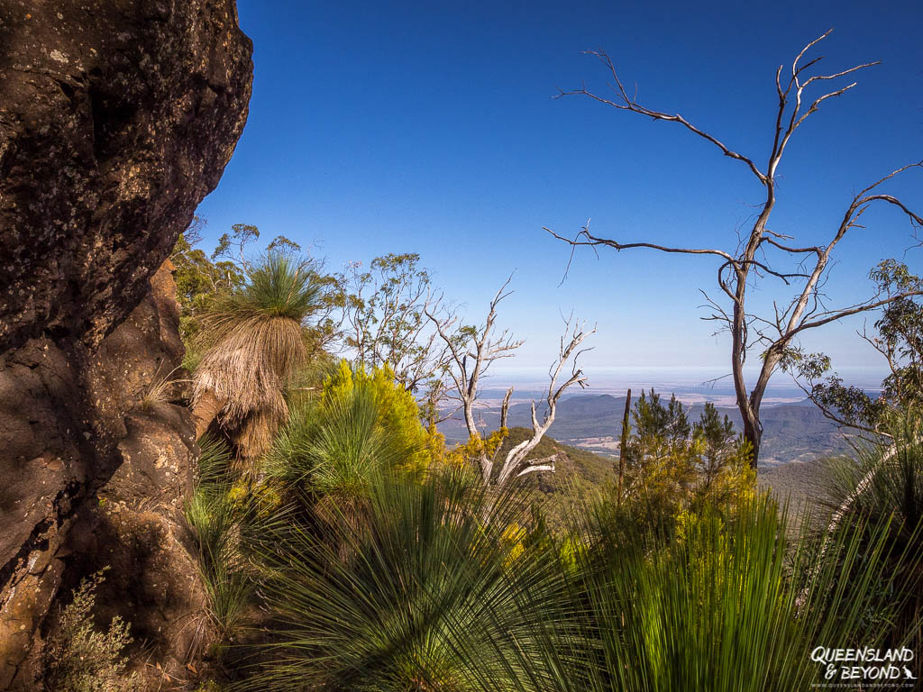
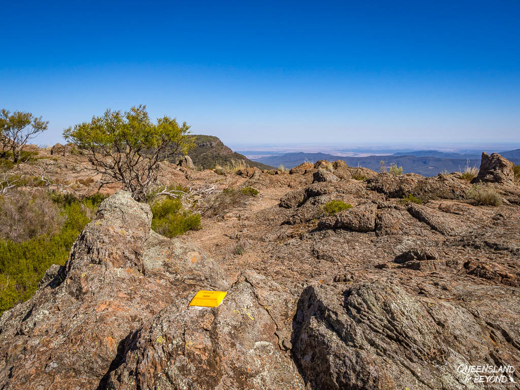
1. YULLUDUNIDA ‘CRATER’
BASIC TRAIL INFO
Distance: 4km return with 350m elevation gain
Difficulty: Moderate to hard (strenuous in hot weather)
Time: 2-3 hours
Trailhead: Green Camp carpark
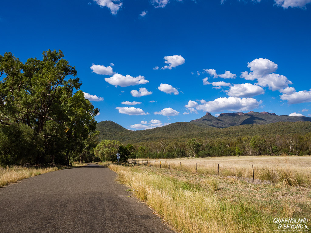
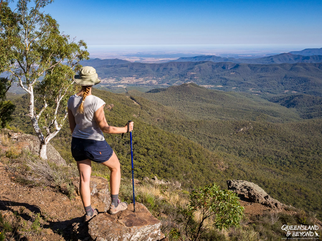
The hardest of the short Mount Kaputar walking trails but the views from the top are sensational!
READ MORE: 10 of My Favourite Hikes in Australia

Two-thirds of the hike is up a relatively steep trail involving a fair few steps, especially at the start. It’s mostly trees and bushland but you’ll get some views here and there so the hike up was actually much prettier than I’d expected.

The last section of the trail is unmarked and just a rocky scramble up the side of the bluff of Mount Yulludunida. On the way down, we actually found some rock cairns marking some sort of a trail but they were impossible to spot on the way up. We made our own way, which wasn’t anywhere near as hard as it looked at first.
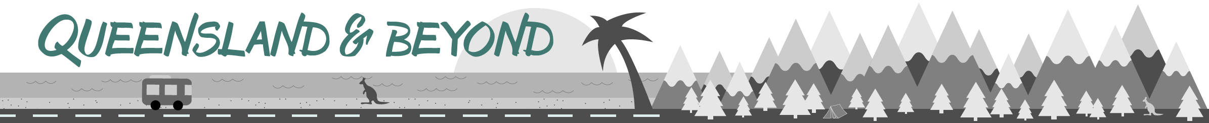
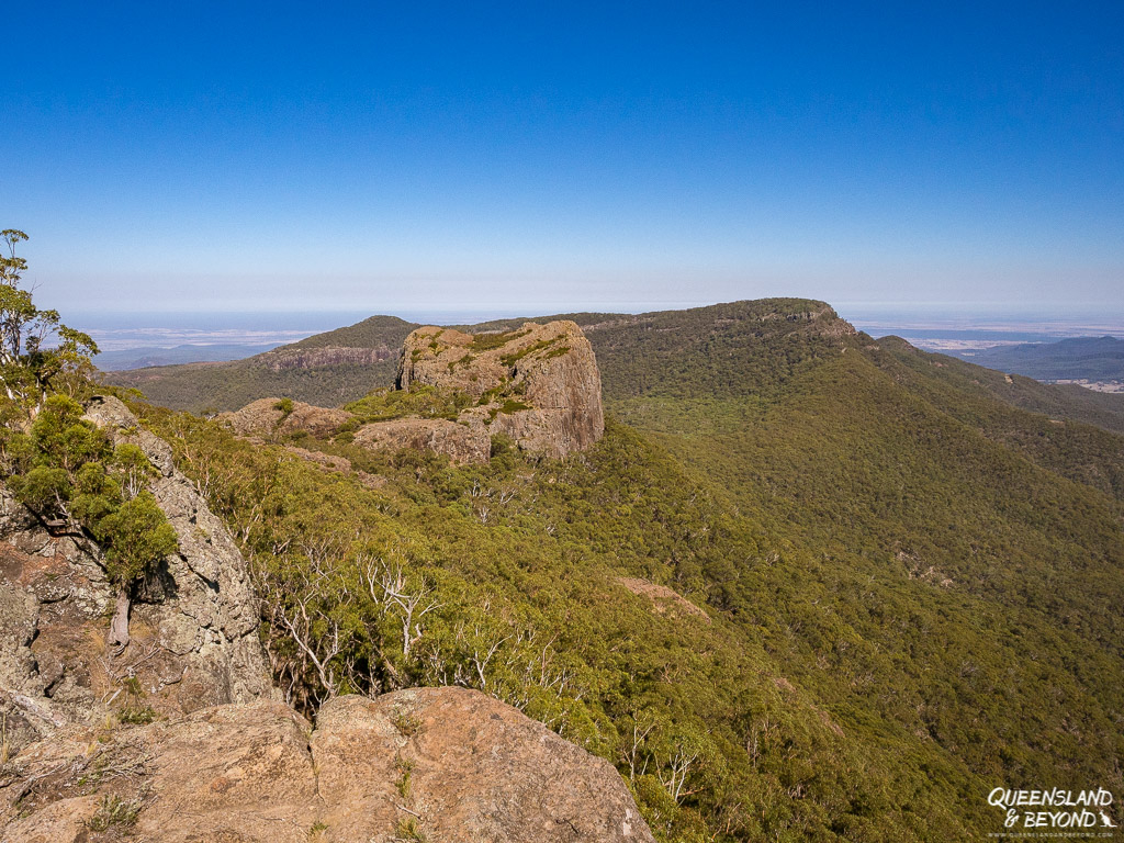
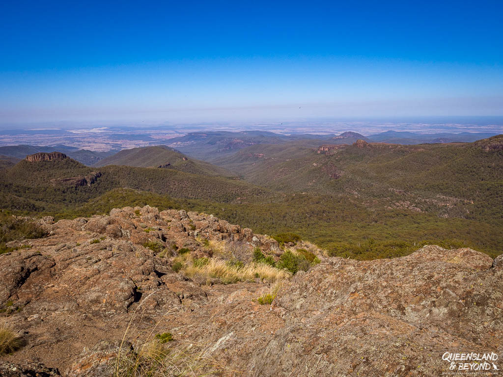
Once you’re on top of the bluff, you’ll get spectacular, almost 360° views of your surrounds, the Nandewar Ranges and into Yulludunida Crater.
Apparently Yulludunida Crater is mislabelled as it’s not actually a crater but a ring dyke. Both are formed due to volcanic lava action but one has the lava flowing out on top (crater) while the other has lava draining away underneath (ring dyke).
Or something like that. I’m no geologist, just an avid reader of national parks’ signage and easily impressed with stunning natural phenomena.

The last section of the hike is obviously completely exposed as you scramble up the rocky bluff. The sun is fierce in these parts of Australia so make sure you hike early or during the cooler months of the year.
We started about 6:15 am and had plenty of shade but later in the day this would be a seriously hot hike as the sun comes around the range and roasts you the entire way up.

2. MOUNT CORYAH WALK
BASIC TRAIL INFO
Distance: 4km return with some elevation gain
Difficulty: Moderate
Time: 2-3 hours
Trailhead: Coryah Gap picnic area
If Yulludunida sounds a bit too much, Mount Coryah is the perfect alternative.
This walk takes you up to the summit of Mount Coryah, which is nowhere near as strenuous as it might sound. There’s a couple of steel bridges and staircases involved, and gee, I always find them fun!


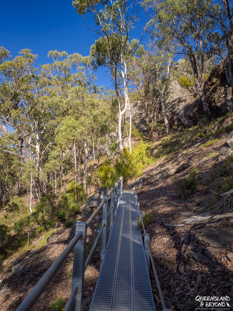

Once you’ve climbed up, it’s a gorgeous walk through sub-alpine terrain with plenty of fantastic views along the way.
You end up circumnavigating Mount Coryah and for the last part of it, you walk on a rocky ledge along the cliff’s edge. It’s fairly narrow but not really scary (I think Parks NSW advise not to take small children though).
Near the summit, you’ve got the option to hike further into the wilderness to one of the historic huts. The trail is unmarked and best attempted if you know what you’re doing.

On the way back, we met some oldies setting out for the old hut on a overnight hike. I’m always mega-impressed seeing 60-70 year-olds going on multi-day hikes, especially when you’d have to carry all your water like on this hike!
3. THE GOVERNOR (CORRUNBRAL BORAWAH)
BASIC TRAIL INFO
Distance: 2km return with some elevation gain
Difficulty: Moderate
Time: 1.5-2 hours
Trailhead: The Governor carpark
None of the walks we went on were particularly packed but The Governor seemed to be one of the more popular ones. And by popular I mean that we met maybe six or seven people.
It’s another summit climb and most of it is exposed. We hiked up in the mid-late morning and it was hot enough that I wouldn’t have wanted to go any later.
Until you get to the rock scramble part, the trail itself isn’t hugely picturesque. But there’s a giant boardwalk spiralling down a rocky ledge and a couple of steel ladders to make the walk itself fun enough.
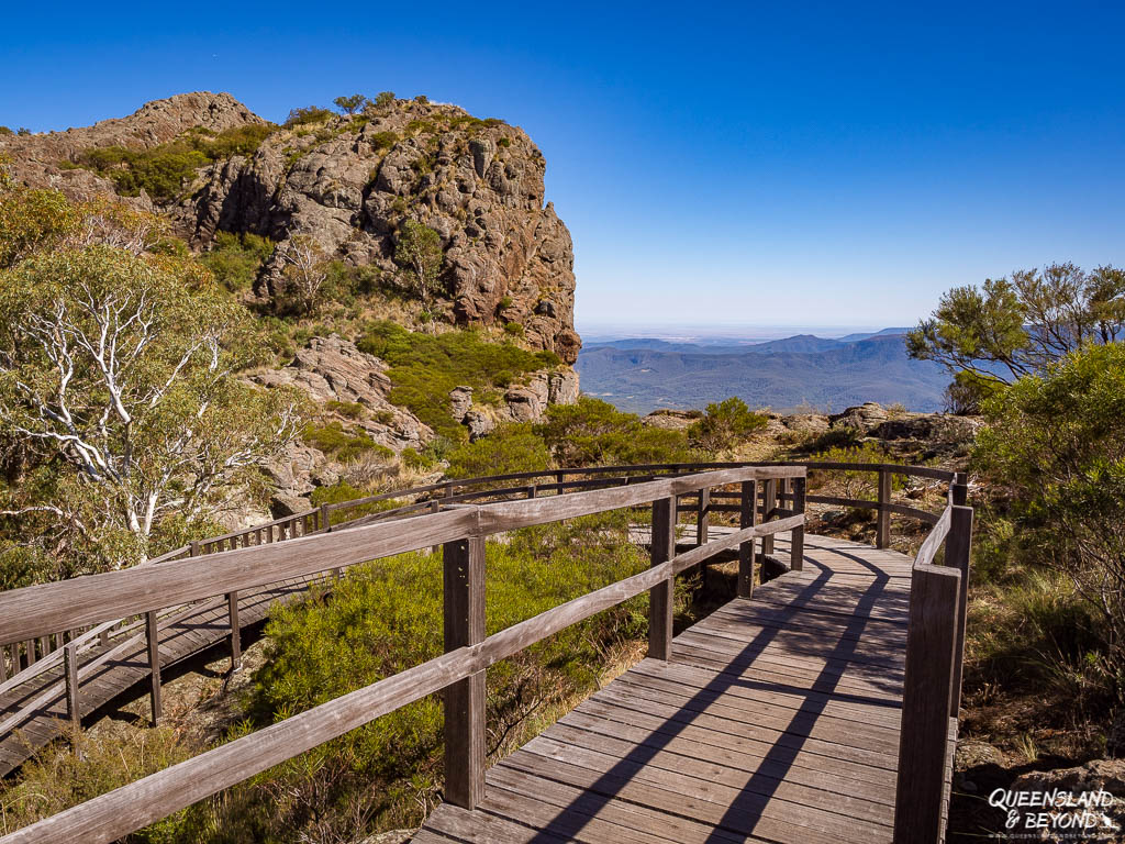
I didn’t love the views from this peak as much as from other vantage points in the park but it’s still pretty nice, especially if you didn’t do any of the other hikes.
I figured this volcanic plug would actually make a nice spot for sunset but I didn’t get there. Just make sure you grab a torch for that scramble down the rocks in the dark.
If you’re feeling lazy or aren’t quite up for a 2km moderate hike, the Governor Lookout is only 300m from the carpark. Early morning – or perhaps sunset – would be best for photos.
4. BUNDABULLA CIRCUIT
BASIC TRAIL INFO
Distance: 3.5km loop
Difficulty: Moderate
Time: 2-3 hours
Trailhead: Lindsay Rock Tops carpark / Dawson Springs campground (adding another 1.3km for the link track)
The Bundabulla Circuit – don’t you love the names in Australia sometimes? – loops around the Kaputar plateau and connects the Lindsay Rock Tops Walk with the Bundabulla Lookout and Eckford Lookout trail.
You could do them as individual return walks but the loop is fairly flat so they’re easily combined and ticked off in one go.
The Lindsay Rock Tops is one giant lava field, which really isn’t as interesting as you might think. You’ll get some nice views into the plains but unless you’re into geology, the lava terraces probably aren’t going to keep you glued to the rocky ground for too long, even if you’re spying for lizards and snakes.

The trail then follows snow gum woodlands and tea tree scrub with side trips to a few lookouts. My favourite by far was Eckford Lookout as it takes you past a herbfield full of very small plants and delicate, soft leaves.


Most of the trail is shady but it still felt pretty hot in the late afternoon.
5. SAWN ROCKS
BASIC TRAIL INFO
Distance: 1.5km return
Difficulty: Easy
Time: 0.5-1 hour
Trailhead: Sawn Rocks carpark (Sawn Rocks section, 35km north-east of Narrabri)
The Sawn Rocks are an incredible sight.
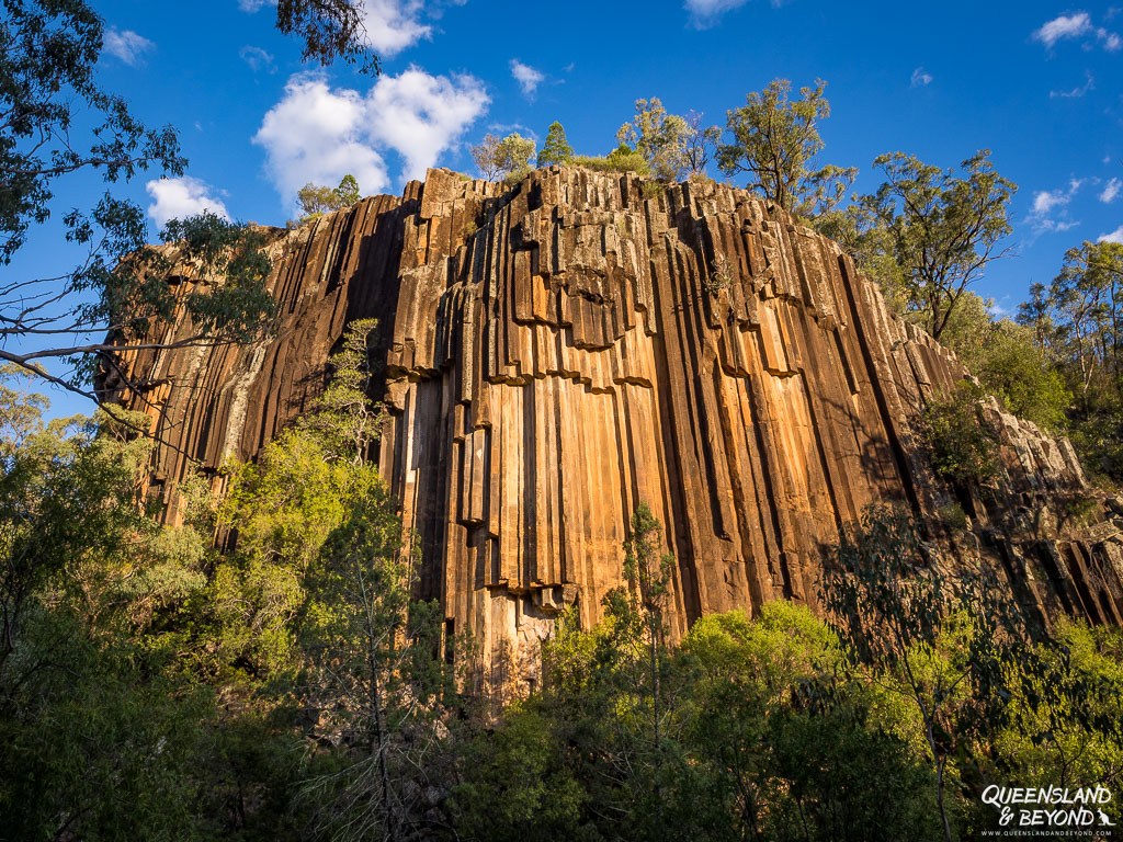
This rock formation showcases what’s known as organ-piping: perfectly shaped, pentagonal rock columns running down a cliff face. It looks as if someone had chiselled them out of the rock by hand.
They are apparently formed when lava flow cools slowly and evenly, and the lava crystals in the molten mass then align perfectly into geometric shapes. It looks quite stunning, especially in the late afternoon glow – so, yes, best time for photos is late afternoon as the sun basks Sawn Rocks in golden splendour.
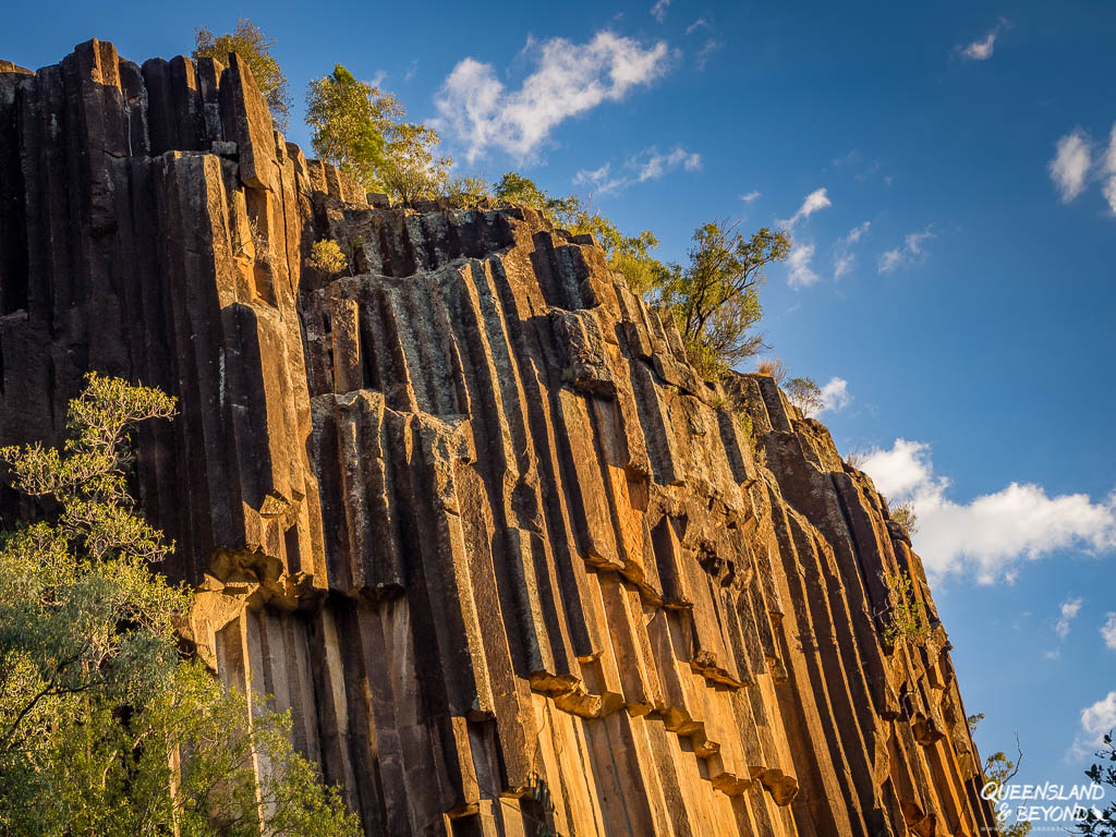

The walk itself is more of a stroll along a very flat path. The fun comes as you climb into the dry creek bed and explore these massive pieces of broken organ-piping lying around everywhere. Made me wonder when the next piece might crack and break off the rock face, crashing into the creek bed.

The only downside to the Sawn Rocks is that they’re not in the Mount Kaputar plateau section, and it’s effectively an hour’s drive to the rocks if you’re staying in the national park. But if you get there late afternoon, you’ll see Mount Kaputar bathed in sunset hues on the way back to your campsite.

OTHER WALKS AT MOUNT KAPUTAR
A few other Mount Kaputar hikes you could do:
- Kaputar Plateau Walk (moderate 6km loop): Along fire trails, which surprisingly didn’t sound that exciting so we gave it a miss
- Scutts Hut & Kurrawonga Falls (hard 19km return): Usually done as an overnight walk
- Waa Gorge (moderate 2.5km return): We seriously contemplated doing this one but the Waa Gorge section is outside the Kaputar plateau area; it was just too far out of our way to drive there and back
- Euglah Rock (easy 2km return): We actually did this one on our first night; it’s an easy stroll to a pleasant lookout

LOOKOUTS AT MOUNT KAPUTAR
There are also a few lookouts in the park where you literally park right next to the viewpoint:
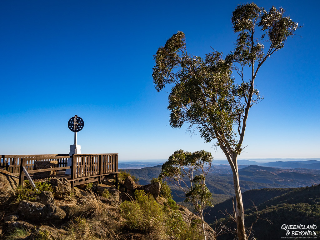
- Mount Kaputar Summit Lookout: Unless you start at Dawsons Spring campground, it’s about a 50m boardwalk to the summit; at 1,550m elevation, you’ll get splendid views into the wilderness surroundings; sunrise or sunset would be a fantastic time
- Doug Sky Lookout: On a clear day, you can see as far as Warrumbungle National Park from here; also gorgeous for sunset hues (you won’t see the sun set from here but you’ll get the incredible sunset bands so common in the outback)
- Kaputar Western Wall Lookout: Not my favourite, the sun always seemed to be in the wrong spot for any decent kind of photo 🙂
SUMMING UP
With the heat beating down on your car, and the road beginning to glimmer and melt into one with the wheat and cotton fields running alongside it, Mount Kaputar begins to feel very remote.
While it was crazy hot at Mount Kaputar over Easter, this national park really is quite amazing! The walks are all worth it (well, the ones we did) and you’ll not only get sprawling views but also interesting rock formations.
Totally one of my favourite national parks in New South Wales!
MORE INFORMATION
If you want to do a 4WD trip through the national park and are organised enough, you could also take the 8km Barraba Track. You’ll need to organise a permit and a key from the café in Barraba beforehand. Otherwise you could walk it or cycle it if this kind of terrain is your thing!
More information, as always, can be found on NSW Parks & Wildlife Service.
MORE POSTS ON HIKING IN AUSTRALIA
My list of all time favourite hiking trails is always changing. Here’s my current one.
- Close to the Gold Coast, Springbrook National Park and Lamington National Park offer some fabulous hikes and waterfalls aplenty!
- The Northern Territory has way more hiking than you might think: There’s a heap of short walks in Kakadu National Park, day hikes at Nitmiluk or half day ones at Ormiston Gorge near Alice Springs. Take your pick!
PIN IT


6 Comments
LC
1 May 2018 at 11:41 AMI love your crimson rosella shot! I find it so hard to get decent pics of them… my lens isn’t anywhere near long enough and they’re so flighty. Also, the Sawn Rocks look bloody amazing.
Kati
1 May 2018 at 9:53 PMMr Crimson Rosella was one happy bird: first he let me watch him for ages, then when I finally decided that ‘yes, I would get up and take a photo’, he let me patiently change my lens and did a little hopping and nibbling on twigs to show off. Of course, once I’d moved into the perfect spot, he decided it was time to fly away! 😀 But yes, I haven’t been able to capture a lot of rosellas – this one was a bit of a poser, I think!
Sawn Rocks was unreal! I can’t recall ever having seen geometric rocks quite like these perfectly shaped gigantic pipes.
Rachael
5 October 2018 at 3:22 PMSome great sounding hikes there! And what cool rock formations at Sawn Rocks!
Kati
7 October 2018 at 8:39 AMHey Rachael,
Yes, Mount Kaputar has some pretty nice, short hikes! There’s a bit of backcountry and longer hikes too but it was a bit hot for those when we were there.
And yeah, Sawn Rocks are amazing! They’re enormous, and I kept wondering the whole time if one would crash down on me as there are tons of pieces strewn about that have clearly come down at some point…
Dan & Beck
12 August 2020 at 7:05 PMHey Kati,
This is such an in-depth guide to hiking at Mount Kaputar.
We’re planning a Northern NSW trip in the coming weeks and this article has been so helpful.
Having the details like the distance, duration, elevation gain and trail head is very useful. Thanks for sharing.
Cheers, Dan & Beck | Travel Made Me Do It
Kati
24 August 2020 at 4:44 PMHi Dan & Beck,
Mount Kaputar is pretty amazing. It’s been a couple of years since we visited and still have really vivid and fond memories of the hikes there. Hope you have a fantastic time, I’m sure it’ll be pretty quiet at this time of the year. 😀